|
|
Woodland Avenue |
|
|
Maps of Woodland Avenue |
||
|
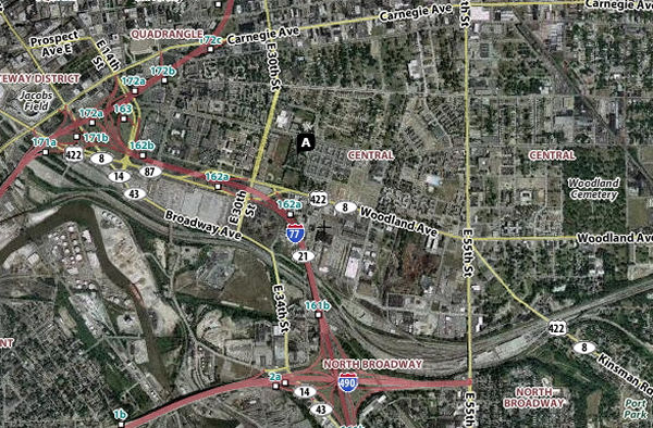
A MODERN MAP
This Yahoo© map blends satellite imagery with labels for major sites and streets. It shows Woodland Avenue from its start at Broadway, to about East 80th Street. The aptly named Cuyahoga ("crooked") River can be seen in the lower left. To display an interactive version of this map, click here. The land near the river was swampy and bug-infested, so in 1796 Cleveland began up the hill, around what is now Public Square. In 1840 the city's first Jews settled southeast of Public Square, near the Central Market (see GATEWAY DISTRICT, upper left) and built their first synagogue in 1846 where Jacobs Field (now Progressive Field) is shown. As the city expanded from its core in all directions, except north of course, ethnic groups tended to not to cross the river. Irish on the near West Side might move west on Lorain Avenue, then to Kamms Corners, then Rocky River, then farther west. Some ethnic groups such as the Polish moved south or southeast. Many Italian immigrants would move east, from Woodland to Mayfield Road near Euclid (Little Italy), then to the suburbs. For the largely Roman Catholic immigrant population that arrived after 1880, these clustering patterns were reinforced by the many nationality-based parishes, where old-country customs and sermons in the old language would be a comfort to new arrivals.
For Jewish Clevelanders, moving "up" to
newer, better housing would mean moving east. Perhaps
one or two moves east in the Central District or along
Woodland, then northeast to Glenville (annexed in 1905)
or east to Kinsman, then to the Heights.
Sam and Minnie
Klausner, documented in our Generations section,
followed that pattern.
|
|
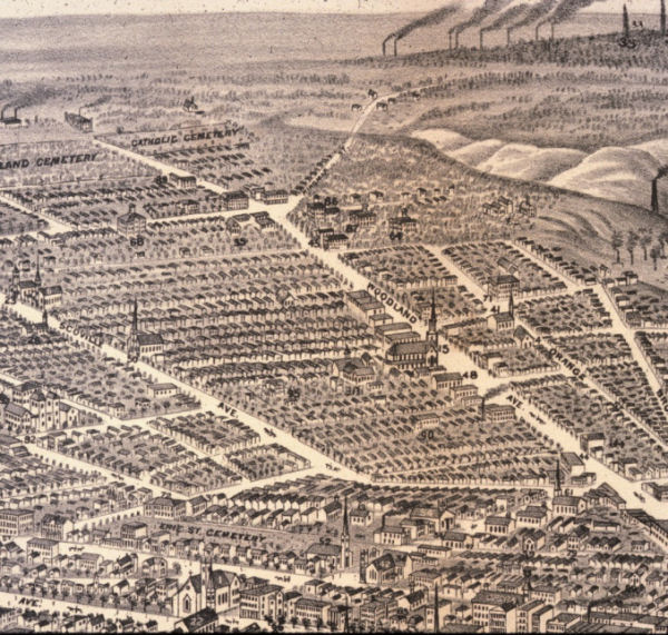
AN AERIAL VIEW - 1877
Source: Western Reserve Historical
Society The lower Woodland Avenue area had some of Cleveland's oldest, most dense and worst housing - some of it dating back to just after the Civil War. For generations it would be home to Cleveland's newest immigrants who would move out as soon as their improved fortunes would allow. Sanitation was poor. Many buildings had outhouses and lacked baths or showers. Cleveland's first public bath houses would be built there. (ECH). The Central Market, the neighborhood where Cleveland's first Jews lived, is at the intersection of Broadway (the street at the far right) and Woodland. Continue to Where it Began - the Central Market Area |